Jakarta Metro Map: A Complete Guide to Navigating Jakarta’s Public Transport System
Jakarta, the capital city of Indonesia, is a bustling metropolis that faces significant challenges in terms of urban mobility. To address these challenges, the city has developed an integrated public transportation system that includes a variety of transport options designed to serve residents and visitors alike. The comprehensive system aims to reduce traffic congestion, provide eco-friendly travel solutions, and make commuting more accessible.
The Jakarta metro map plays a central role in helping people navigate this sprawling city. It serves as a visual guide to the interconnected transport systems available, making it easier for commuters to move around the city efficiently. This network includes multiple modes of transport, each serving different purposes but working together to create a seamless travel experience.
Key components of Jakarta’s public transportation network include Transjakarta, MRT, KRL, and LRT. Transjakarta is the city’s bus rapid transit system, which covers various routes across the city, offering fast and affordable options for urban commuters. The MRT (Mass Rapid Transit) is Jakarta’s metro system, which provides a modern, rapid travel experience, especially for those traveling within the city’s central areas.
The KRL (Commuter Line) connects Jakarta to its suburban areas, providing vital links to the city’s outskirts. Meanwhile, the LRT (Light Rail Transit) system is gradually expanding, providing additional connections that help reduce congestion in key areas. Each of these transport types is integrated into the broader Jakarta metro map, allowing passengers to easily switch between modes of transport as needed.
Whether you are using the Transjakarta buses for short-distance travel or taking the MRT for a longer, faster commute, the Jakarta metro map is an essential tool for planning your journey. By clearly displaying routes, stops, and transfer points, it ensures that users can navigate the city’s transport system with ease, making it an indispensable resource for both residents and tourists.
Jakarta’s public transportation network is a complex but highly efficient system, with each transport type contributing to the overall goal of improving urban mobility. The Jakarta metro map is the key to understanding how these various modes of transport interconnect, allowing commuters to travel seamlessly across the city. Whether you’re using the MRT, KRL, LRT, or Transjakarta, the map helps you plan your journey and choose the best route, making your travel experience in Jakarta smoother and more efficient.
Table of Contents
ToggleUnderstanding the Jakarta Metro Map and Its Importance
The Jakarta Metro Map is an essential tool for anyone navigating the city’s complex public transportation system. It provides a clear, organized layout of all the available transport routes, including those for the MRT, Transjakarta, KRL, and LRT, which are crucial for urban commuting. For both locals and visitors, understanding how to read and use this map is key to moving efficiently across Jakarta.
The map itself is designed to be user-friendly, even for those unfamiliar with Jakarta. It highlights various metro routes across the city, showing the stops and connecting points between different modes of transport. The MRT lines, in particular, are easy to locate on the map with distinct color coding, making it simple to identify your route and stops along the way. The Jakarta metro map also provides an overview of city transportation options, giving you a sense of how all the transport systems work together to facilitate seamless travel.
One of the most important aspects of the Jakarta metro map is its ability to help users understand the connection points between the different transit systems. For instance, many metro routes overlap with Transjakarta bus lines, allowing passengers to switch from one mode of transport to another without having to go out of their way. This integration is marked on the map, making it easier for commuters to plan their journeys. The public transit map also includes information on station locations, service hours, and ticketing, which is vital for smooth and hassle-free travel.
Using the Jakarta metro map can significantly improve your commuting experience. Whether you’re traveling from the heart of Jakarta to its outskirts, or hopping between different parts of the city, the map gives you a detailed, easy-to-understand guide for your journey. It helps you save time by showing the most efficient routes and transfer stations, ensuring that you don’t waste time navigating the city’s complex traffic or transport routes.
Navigating the Transjakarta Bus Network: An Essential Guide
Transjakarta is one of the key components of Jakarta’s public transportation network, offering an affordable, reliable, and efficient way to navigate the city. As the capital’s bus rapid transit (BRT) system, Transjakarta is vital for reducing traffic congestion and providing a seamless commuting experience across Jakarta. Understanding how to navigate the Transjakarta bus routes is essential for anyone using the public transport system, especially when combined with the Jakarta metro map.
Exploring Transjakarta Bus Routes
The Transjakarta bus routes are an extensive network of bus lines that cover a wide range of areas across Jakarta. These routes connect key neighborhoods, business districts, and transport hubs, providing an affordable alternative to private cars and other forms of transportation. The routes are color-coded and marked on the Jakarta metro map, making it easy for commuters to find their way.
The bus network is designed to integrate with other modes of transport, including the MRT, KRL, and LRT. For example, many Transjakarta bus routes intersect with the MRT lines at major transfer stations, allowing passengers to switch between buses and trains with ease. This integration helps ensure that people can travel across the city without interruptions, making the public transport system more effective and user-friendly.
Key Features of Transjakarta Bus Stations
Bus stations are strategically located along the Transjakarta routes, providing access to important areas of Jakarta. These stations serve as transfer points between different bus routes and other forms of public transport. Many of the larger bus stations are located near MRT stations, offering easy access for passengers to switch between the two systems.
Each bus station is equipped with modern facilities, including ticketing counters, waiting areas, and information displays that provide up-to-date schedules. These stations are marked on the Jakarta metro map, ensuring that travelers can easily find their nearest station and plan their journeys effectively.
How Transjakarta Complements the Jakarta Metro Map
The Jakarta metro map is an invaluable resource when navigating the city’s complex public transportation system, and the Transjakarta network is an essential part of it. By showing the locations of Transjakarta routes, bus network connections, and key bus stations, the map provides a clear visual representation of how the buses fit into the broader transportation system.
For example, when traveling from a neighborhood serviced by Transjakarta to an area with access to the MRT, the Jakarta metro map helps you identify the best transfer points. This seamless integration allows commuters to easily move between the different modes of transport, reducing travel time and improving efficiency.
Why You Should Use Transjakarta for Your Daily Commute
Using the Transjakarta system is one of the best ways to avoid the city’s notorious traffic jams while enjoying a smooth and comfortable ride. The extensive coverage of the bus network ensures that you can travel to nearly every part of Jakarta, with affordable fares and frequent services. By using the Jakarta metro map, you can plan your route, identify transfer points, and ensure you have a seamless journey from start to finish.
MRT Jakarta: Key Features and Routes You Need to Know
The MRT Jakarta system is a groundbreaking addition to Jakarta’s public transportation network, offering a modern, efficient, and rapid way to travel across the city. As Jakarta continues to expand and modernize, the MRT system plays a pivotal role in addressing traffic congestion and providing commuters with a reliable travel option. In this article, we’ll explore the MRT routes, its key features, and how it integrate with other public transport services in Jakarta.
Exploring the MRT Jakarta System
The MRT Jakarta (Mass Rapid Transit) system is a state-of-the-art metro network that provides fast, comfortable, and eco-friendly travel through the heart of Jakarta. Opened in 2019, the system is one of the city’s most important developments in improving urban mobility. The MRT system is designed to connect key areas of Jakarta, providing an efficient alternative to driving in the city’s heavy traffic.
The Jakarta metro map displays the various MRT routes running throughout the city, allowing commuters to easily identify their nearest stations and plan their journey. The initial line, the North-South Corridor (Line 1), connects major stations from the northern part of Jakarta to the southern regions, serving both residential and business districts. The map also highlights the planned extensions, which will further expand the reach of the MRT system.
Understanding MRT Jakarta Routes and Stations
One of the key features of the MRT Jakarta system is its well-planned network of MRT routes. These routes cover essential areas within Jakarta, ensuring that commuters have access to convenient, direct connections between major parts of the city. The MRT routes are displayed on the Jakarta metro map, which makes it easy for users to navigate the system.
For example, the North-South Corridor of the MRT links important business districts like Sudirman and SCBD with residential areas such as Lebak Bulus in the south. The MRT stations are strategically located near key hubs like shopping centers, office buildings, and other public transport systems, ensuring that passengers can seamlessly transfer between the MRT and other forms of transport, such as Transjakarta buses or the KRL commuter trains.
The Jakarta MRT stations are equipped with modern amenities such as air-conditioned waiting areas, escalators, elevators, and digital displays providing real-time train schedules. These features make traveling by MRT more convenient and accessible for people with various needs.
How MRT Jakarta Integrates with Other Jakarta Transport Systems
The success of the MRT Jakarta system relies not only on its routes but also on its seamless integration with other forms of public transportation in Jakarta. The Jakarta metro map plays a crucial role in helping commuters understand these interconnections.
Many MRT stations are designed as transfer points between the MRT system and other major transit systems, such as the Transjakarta buses and the KRL commuter line. For instance, you can easily transfer between the MRT and Transjakarta at stations like Bundaran HI, making it easy to continue your journey across the city without having to leave the station.
This integration significantly improves the overall efficiency of Jakarta’s public transport system. With a single Jakarta metro map, commuters can plan their trips by combining the MRT with other transport services, ensuring that they can travel from one area to another in the shortest time possible.
Why You Should Use the MRT Jakarta System for Your Daily Commute
Using the MRT Jakarta system is one of the most efficient ways to navigate the city. The MRT offers fast, reliable, and air-conditioned travel, allowing passengers to bypass the often chaotic traffic in Jakarta. By using the Jakarta metro map, commuters can easily identify the best routes, discover nearby MRT stations, and switch between different modes of transport as needed.
In addition to its speed and convenience, the MRT system is also an eco-friendly choice, helping to reduce carbon emissions and air pollution in the city. As Jakarta continues to expand its public transportation network, the MRT will play an increasingly vital role in making the city more livable and sustainable.
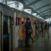
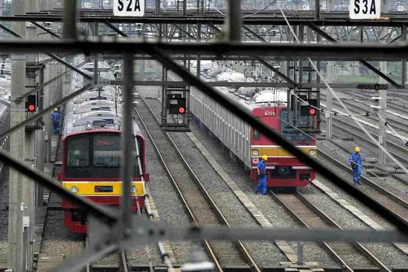
KRL Commuter Line: How It Connects Jakarta’s Suburbs to the City Center
The KRL (Keretapi Rel Listrik) Commuter Line is one of the most vital components of Jakarta’s public transportation system. Connecting the urban center to surrounding suburbs, the KRL plays a crucial role in providing commuters with a fast and efficient way to travel into the city. With multiple routes and stations strategically located, the KRL is a key element in making daily commutes smoother and more convenient for residents in Jakarta and its surrounding areas.
Understanding the KRL Commuter Line and Its Routes
The KRL commuter line is designed to serve as a direct link between Jakarta’s urban core and its surrounding suburban areas. The system spans several lines that run from the city center to the outskirts, offering a vital connection for people traveling from suburban neighborhoods to central Jakarta for work, education, and leisure. The routes covered by the KRL are shown clearly on the Jakarta metro map, making it easy for passengers to navigate their journey.
The KRL routes are color-coded for easy identification and cover key areas in Greater Jakarta. For instance, the Blue Line runs from Jakarta Kota to Bogor, while the Red Line connects Jakarta to Tangerang. These routes are part of the larger commuter line Jakarta network, providing easy access to different parts of the metropolitan area. The KRL Jakarta map is an essential tool for commuters, helping them understand the routes, transfer points, and travel times.
Exploring KRL Commuter Stations
Commuter stations along the KRL network are conveniently located to serve passengers traveling to and from various destinations in Jakarta. These commuter stations are major transport hubs where passengers can transfer between the KRL and other modes of transport, such as the Transjakarta buses or the MRT system. Many of these stations are situated in the heart of suburban areas, allowing passengers to easily access their homes or workplaces.
The KRL commuter stations are well-equipped with modern amenities, including ticket vending machines, waiting areas, and real-time schedule displays. These stations are also shown on the Jakarta metro map, ensuring that travelers can find the best stations for their routes and plan their travel effectively.
How KRL Connects Jakarta’s Suburbs with the City Center
The primary role of the KRL commuter line is to provide seamless transportation between Jakarta’s suburbs and the city center. The KRL routes form a crucial bridge that enables people living in surrounding areas like Depok, Bekasi, and Tangerang to access central Jakarta’s business districts, schools, and other key locations. Without this efficient transportation system, commuting to Jakarta from its suburban areas would be far more difficult and time-consuming.
By connecting suburban areas to Jakarta’s urban core, the KRL significantly reduces travel times for thousands of commuters every day. With the help of the Jakarta metro map, passengers can easily navigate the commuter line’s network and plan their journeys, whether they are traveling from suburban neighborhoods to major commercial hubs like Sudirman or from residential areas to popular tourist spots.
Using the KRL Map to Plan Your Commute
The KRL Jakarta map is a key resource for anyone using the commuter line to travel in and out of the city. It displays all the major KRL routes and commuter stations, allowing users to identify their starting points, destination stations, and the best connections. The map also includes important details such as station names, interchanges, and train schedules, helping passengers plan their trips more efficiently.
To use the KRL map effectively, it’s important to identify which route you need to take and whether you’ll need to transfer at any major station. For instance, if you are traveling from Bogor to Jakarta, you will need to catch the Blue Line, and if you’re switching to another mode of transport like Transjakarta or MRT, you’ll find those transfer points marked on the map.
LRT Jakarta: Expanding the Public Transport Network
The LRT Jakarta system is a significant development in the city’s ongoing efforts to improve urban mobility and reduce traffic congestion. As part of Jakarta’s broader transportation network, the Light Rail Transit (LRT) system plays a key role in connecting different parts of the city and offering a modern, efficient, and environmentally friendly transport option. In this article, we’ll explore the LRT routes, LRT stations, and how the system fits into Jakarta’s expanding public transport network.
Understanding LRT Jakarta and Its Routes
The LRT Jakarta system is designed to provide a light rail option for travelers across the city. Unlike the heavier MRT system, the LRT uses smaller trains and operates on elevated tracks, allowing it to bypass Jakarta’s dense traffic. The LRT routes are marked on the Jakarta metro map, which makes it easier for commuters to find their way and plan their journey.
Currently, the LRT system operates along several key routes that connect important districts of Jakarta. One of the primary lines runs from the eastern part of the city to the western suburbs, providing commuters with a fast and efficient way to travel across areas that are traditionally underserved by other forms of public transport. The LRT network is designed to complement existing transport systems, such as Transjakarta and MRT, with easy transfer points along the way.
The Importance of LRT Stations in Jakarta’s Public Transport Network
LRT stations play a crucial role in the success of the LRT system. These stations are strategically placed to serve as key hubs where passengers can board and exit trains, as well as transfer to other public transport modes, such as the MRT or Transjakarta. Each LRT station is designed to be user-friendly, with facilities like ticketing counters, waiting areas, and real-time information displays to keep commuters informed about train schedules.
The LRT stations are also located near major residential, commercial, and educational areas, making it easier for commuters to travel to and from their daily destinations. The stations are visible on the Jakarta metro map, helping travelers find the most convenient stop for their journey. As the LRT network expands, more stations will be added to ensure greater accessibility and convenience for Jakarta’s growing population.
How the LRT System Integrates with Other Jakarta Transport Services
One of the most important features of the LRT Jakarta system is its ability to seamlessly integrate with other parts of Jakarta’s public transport network. The Jakarta metro map is an invaluable tool for commuters in navigating these connections, as it shows how the LRT works in tandem with other modes of transport like the MRT and Transjakarta.
For example, many LRT stations are located near MRT stations, making it easy for passengers to transfer between the two systems. Similarly, LRT routes often overlap with Transjakarta bus lines, allowing commuters to switch between modes of transport without leaving a station. This integration ensures that passengers can move efficiently from one point to another, whether they’re traveling within the city or going to the suburbs.
Why the LRT System is Important for Jakarta’s Public Transport Expansion
The LRT Jakarta system is a vital part of the city’s ongoing efforts to expand and modernize its public transport network. With Jakarta’s population continuing to grow and the city facing increasing traffic congestion, expanding the public transport options is essential for improving the quality of life for commuters. The LRT network provides an eco-friendly, rapid transit option that helps reduce the burden on Jakarta’s overstrained roads.
The introduction of the LRT system allows for better connectivity between neighborhoods, reduces travel time, and provides an efficient alternative to using private cars. The LRT Jakarta system also complements the existing MRT and Transjakarta systems, offering passengers multiple options for getting around the city.
As Jakarta’s public transport network continues to evolve, the LRT will play a crucial role in offering a modern, efficient, and environmentally friendly solution to the city’s transportation challenges.
Exploring Jakarta’s public transportation system, including the Jakarta metro map, offers a comprehensive understanding of the city’s transit options. For those interested in experiencing Jakarta’s vibrant shopping and culinary scene, the Jakarta Shopping Tour provides an immersive journey through the city’s markets and eateries.
Discover Jakarta’s Shopping and Culinary Delights
The Jakarta Shopping Tour is designed to showcase the city’s rich culture and diverse shopping experiences. Participants will visit iconic shopping centers, local markets, and renowned eateries, all easily accessible via Jakarta’s efficient public transport system. This tour offers a seamless blend of shopping and culinary exploration, making it an ideal way to experience Jakarta’s vibrant atmosphere.
Book Your Jakarta Shopping Tour Today
Ready to embark on this unforgettable journey? Visit Ekaputra Tour‘s official website to learn more about the Jakarta Shopping Tour and secure your spot. Our expert guides will ensure a memorable experience as you explore the best of Jakarta’s shopping and culinary offerings.
Recent Posts

Tanah Lot Temple: Bali’s Iconic Sea Temple and Cultural Treasure

Ascott Jakarta Indonesia – Luxury Apartment in the City Center